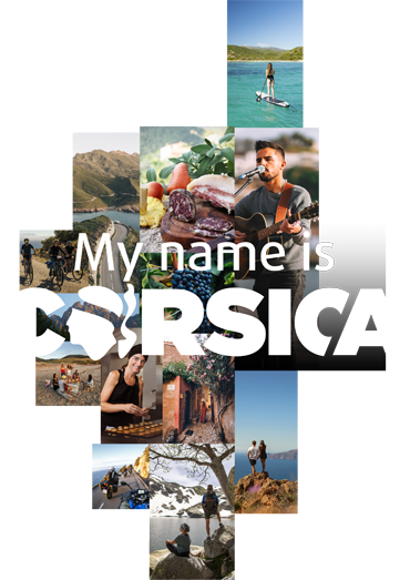
Rechercher...
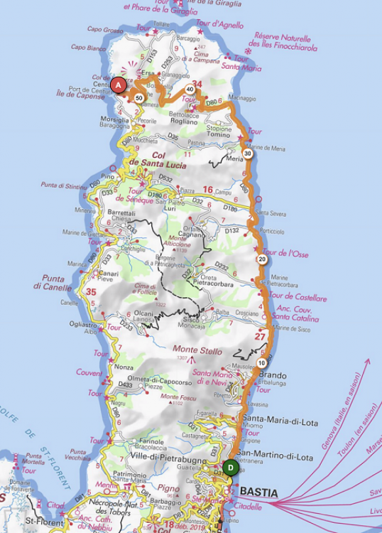
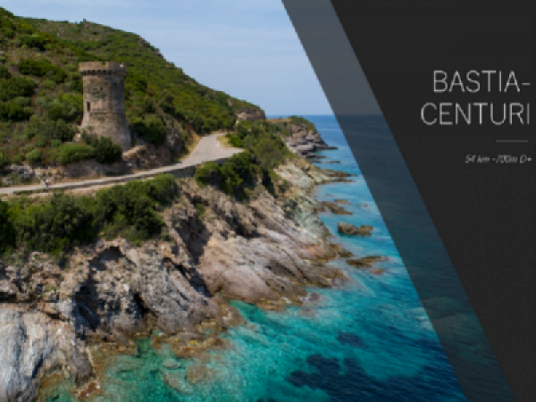
GT20/Stage 1: Bastia - Centuri
East Coast and summit of Cap Corse

To introduce you to and help you prepare for this Grande Traversée de Corse, I’m going to complete it myself, travelling from North to South, i.e. from Bastia to Bonifaziu (Bonifacio).
Just like the GR20, everyone does it their own way to some extent; either in little bits, in circuits, in 12 stages or 10,8,5,3…all in one go!!
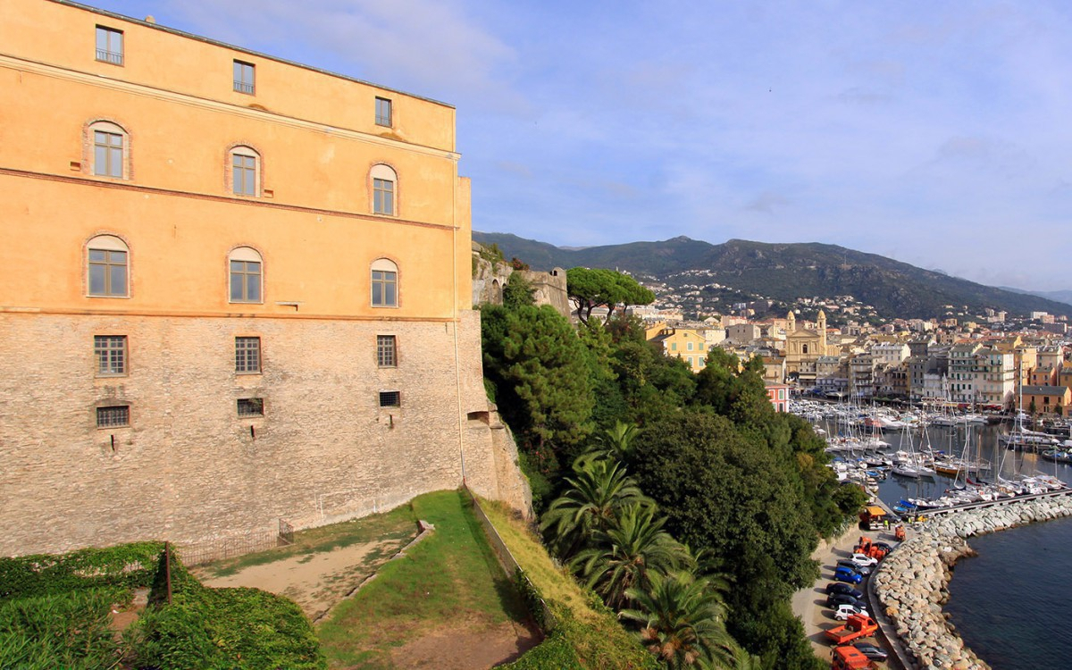
BASTIA: More than just a stop-off town, Bastia is the GT20’s starting or end point depending on whether you are travelling from North to South or vice versa.
As the gateway to Capi Corsu (Cap Corse) or the point at which you leave it, Bastia is Corsica’s second largest and main commercial town with 40,000 inhabitants.
 ©ATC-Sylvain ALESSANDRI
The town, formerly under Genoese rule, offers an especially diverse topography since it is simultaneously on the coast and on the slopes of a mountain 900m in height. The Gulf of San Fiurenzu lies behind this mountain and is accessible by way of the Col de Teghime (535m altitude) but our journey won’t take us that way as instead we will be going via the Capi Corsu.
We are thus en route towards U Capi (“the East Coast”) for this first GT20 stage that will take us to Centuri.
It’s morning and we’re on the East which means we’re lucky as we’ll have the sun. And completing this stage in the morning would be my advice if you want to see the most wonderful colours.
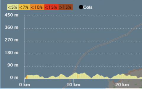
“It’s rolling”, as they say, and it’s just as good for starting or finishing your Grande Traversée, but watch out all the same for false flats and a few slopes, as regardless of the direction you’re going in, although there’s no great pass, there are nevertheless 700 metres of incline in this stage (690 to 720 metres according to the GPS and to OpenRunner and Strava) if you don’t do the detours through the inland villages (see the section entitled “If you want to go further” below). It’s therefore an “easy” stage for Corsica but might just surprise you if you aren’t used to inclines.
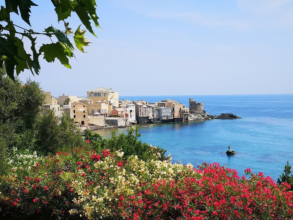
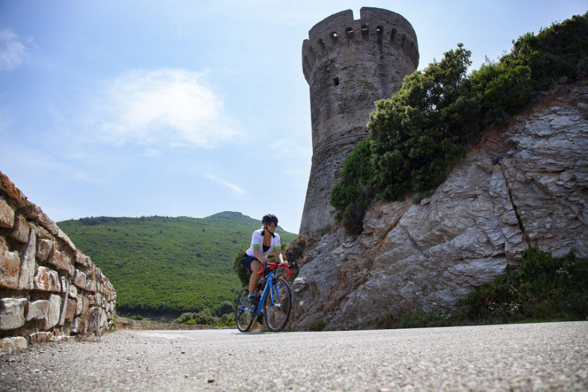
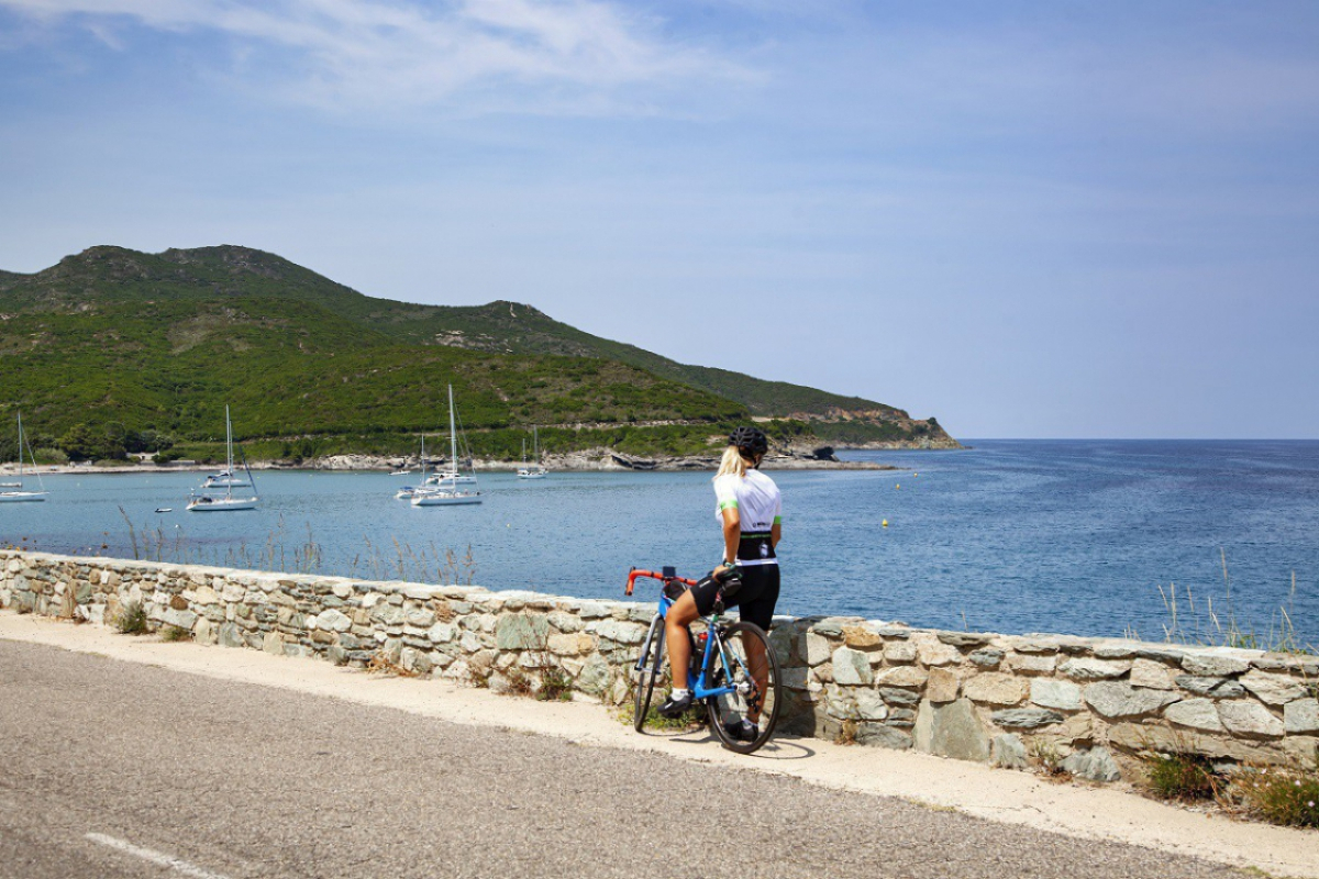
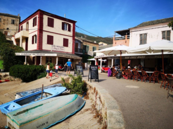
I arrive in Erbalunga for my first break, and whether you choose to do this stage as a “sports cyclist” or a “tourist cyclist”, I strongly urge you to stop off in this little village bursting with character. The little town was built around a small fishing harbour which was one of the island’s main ports and you can visit its famous stone marina and its Genoese tower which stands facing the sea.
 ©ATC-Clémence RAFFI
 ©ATC-Sylvain ALESSANDRI
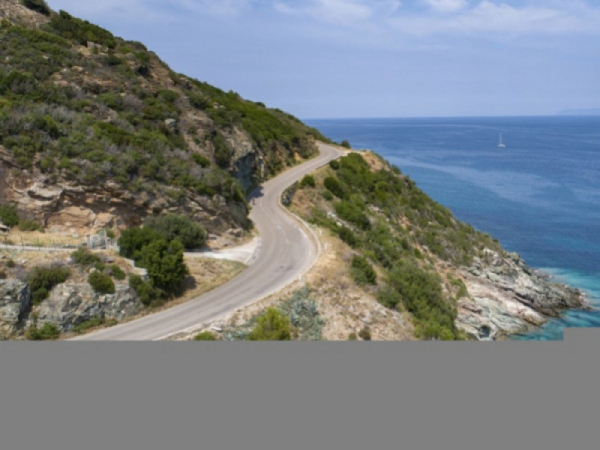
I continue on towards the Marinas at Sisco and then Pietracorbara (the villages are located in the hills above), and arrive at the splendid Tower of Osse located by the roadside with the road curving round it. This is the start of a series of gentle corners on the cliffside.
 ©ATC-Clémence RAFFI
 ©ATC-Sylvain ALESSANDRI
 ©ATC-Sylvain ALESSANDRI
 ©ATC-Clémence RAFFI
 ©ATC-Clémence RAFFI
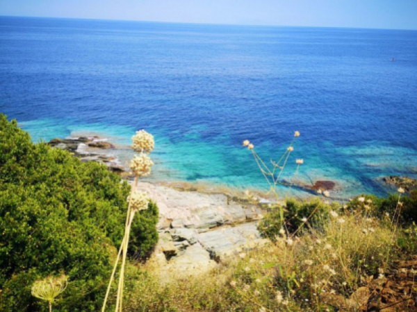
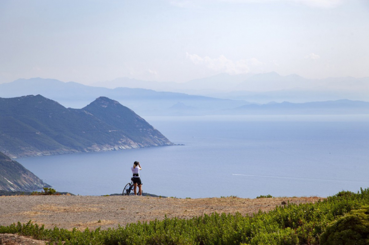
While in fine weather with an unobstructed view, you can see the island of Elba from here, I haven’t been so fortunate today; July’s soaring temperatures and the resulting heat haze have put paid to that possibility.
 ©ATC-Sylvain ALESSANDRI
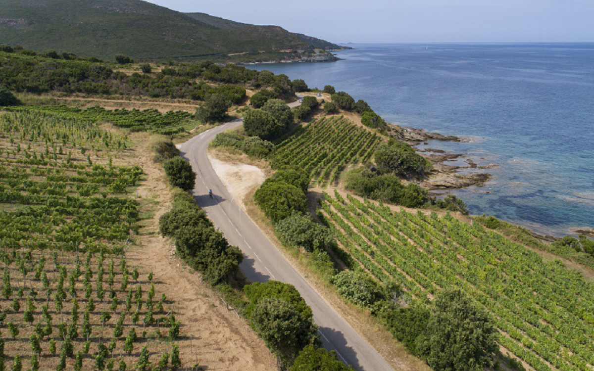
Just after Santa Severa I enter the Domaine Pieretti with vineyards on both sides of the road along the coastline. The Domaine is a large one encompassing the municipalities of Luri, Meria and Petracurbara (Pietracorbara).
 ©ATC-Sylvain ALESSANDRI
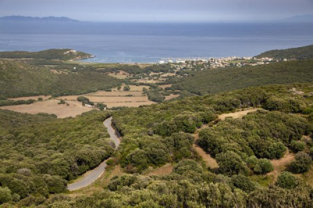
The road is beautiful and runs along the coastline until it reaches Macinaghju (Macinaggio), a bicephalous municipality (Macinaghju/Roglianu), located at the entrance to the Natura 2000 site – a network created by the European Union in order to protect sites of natural or cultural significance. This encompasses the Finochiarola islands and the Domaine de la Casinca.
The road then goes back inland and climbs up to the Col de la Serra, 400 metres above sea-level and the bulk of this stage’s uphill cycling is thus done here, 12 kilometres from the port de Macinaghju.
I recommend that you stop at the Col to admire the view. At certain times of year, there’s also a van that sells cold drinks should you need one. If you’re bikepacking and have a change of shoes with you, you can walk to the Moulin Mattei (Mattei Mill) which is only a few dozen metres from the road.
 ©ATC-Sylvain ALESSANDRI
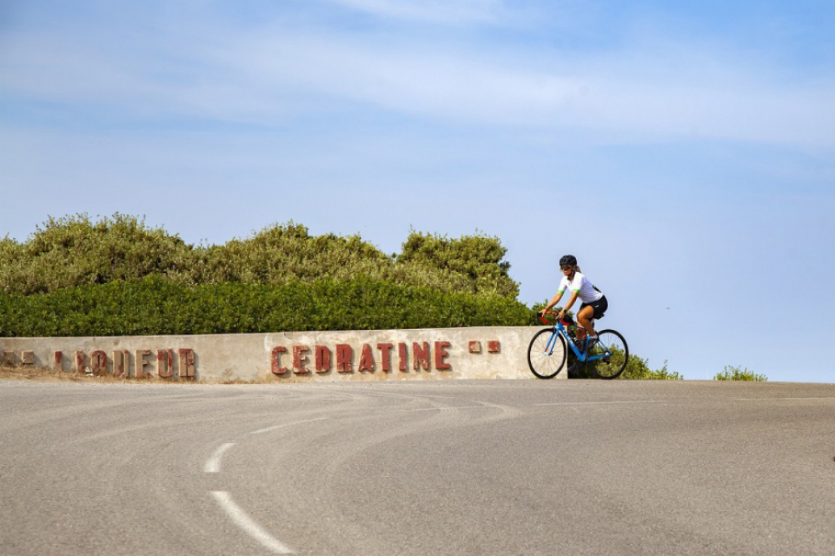
As a historical note, the Moulin Mattei is an old windmill and Cap Corse landmark. After being hit and destroyed by lightning in 1834, it was deemed irreparable and left as a ruin for a whole century until Napoléon Mattei (the inventor of the Corsican aperitif) restored it and transformed it into a promotional entity in the image of his brand. In 2004 the Conservatoire du Littoral (Coastal Conservatory) bought and once again restored it to its 1930 condition, thus giving it a third lease of life. It is currently still in use as a promotional entity, but one in which a number of exhibitions are held in the summer.
 ©ATC-Sylvain ALESSANDRI
To get down to the port of Centuri, leave the main road just a little further on while coming down from the Col and take a right, heading towards the sea.
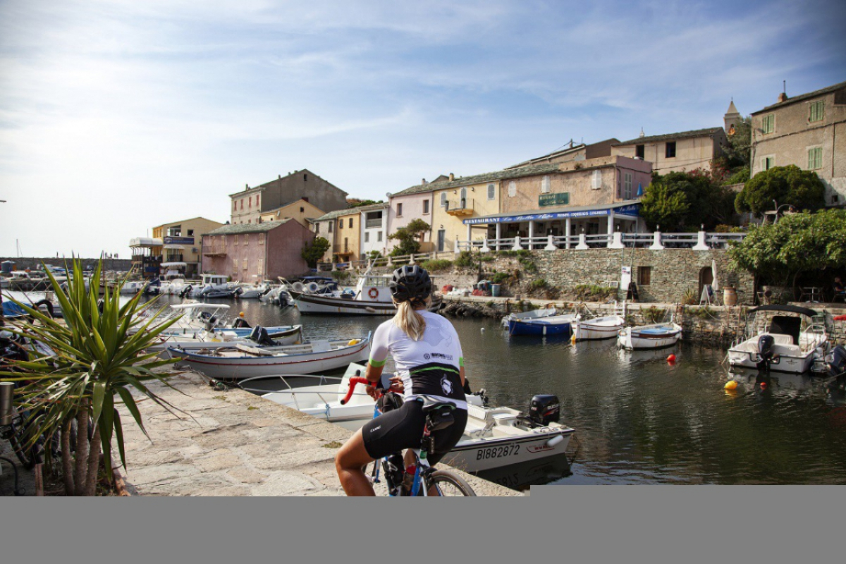
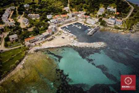
You have arrived. You can either press on or stop in this picturesque little port known in particular for its lobster fishing and where you will find a number of hotels and restaurants (although booking is advised).
 ©ATC-Clémence RAFFI
 ©ATC-Sylvain ALESSANDRI
Bastia Circuits: If you go back to Bastia, I recommend taking one of these 3 options:
- Finish the tour du Cap and return via Patrimoniu (Patrimonio), Barbaghju (Barbaggio) and the Col de Teghime: 120km circuit, 1900m uphill.
- Go down toPino and take the road for Luri, then at Santa Severa, return via the East coast: 105km circuit, 1460m uphill.
- Go down to Mursiglia (Morsiglia) and take the road for Meria, which is magnificent, then come back via the East coast: 97km circuit, 1220m uphill.
Points of interest for tourists in this stage:
Erbalunga, Sisco Marina, the Moulin Mattei and the picturesque seaside villages on the East Coast of Cap Corse.
Further information
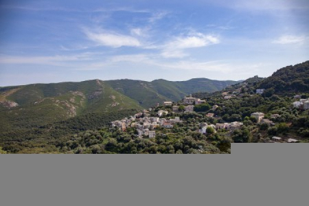
The circuit via Rogliano (historically Cap Corse’s main town): If you’re in good physical shape just now, I’d recommend going through Rogliano village in the hills, just after Macinaggio; you can take a little road on the left (it’s signposted). The road has been resurfaced and is very even.
It’s a bit of a climb to get to the village but the view is truly worth it. Then the road comes back down again from the other side of the village and you get back onto the D80 a little further on. This isn’t a round trip, just a pretty little detour, what’s more in the peace and quiet, and you won’t miss anything from the main route (while avoiding some of the cars) :).
From one of the D80 junctions to the other going through Rogliano: 4.4km/140m uphill//VS//Staying on the D80: 2.6km/130m uphill.
 ©ATC-Sylvain ALESSANDRI
 ©ATC-Sylvain ALESSANDRI
In the Cap Corse the GT20 essentially takes the main road but if you enjoy little inland roads and picturesque villages, there are a number of options as with Rogliano for little detours (be aware that this is uphill).
Examples:
- Ville-di-Pietrabugno and San-Martino-di-Lota to get out of Bastia - D31
- Brando above Erbalunga - D54
- Cagnano and Luri (make sure you rejoin the D80 on the East coast): D232/D32/D332
- Tomino and/or Rogliano: D353/D53
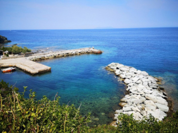
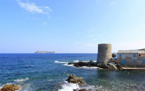
- Barcagio, the Cap Corse summit: D153/D253 starting from Ersa (in either direction, bearing in mind that the D153, on the left, is in poorer condition than the D253, on the right). The little harbour at the very bottom is worth a look and a short stop (there are places you can eat at below).
 ©BikingMan-David SAINTYVES
 ©ATC-Sylvain ALESSANDRI