Rechercher...
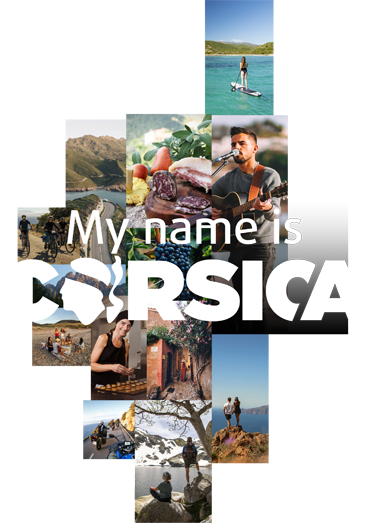
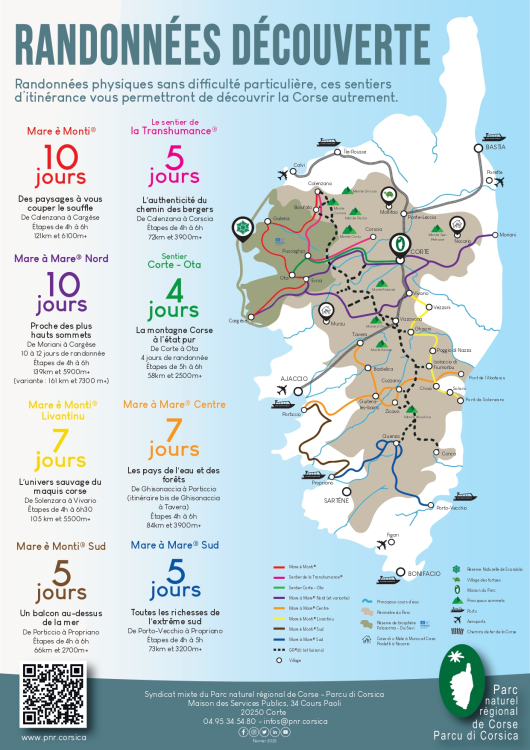
Mare à Mare, Mare è Monti trails... a choice of discovery hikes in Corsica!
Another way to discover Corsica on foot
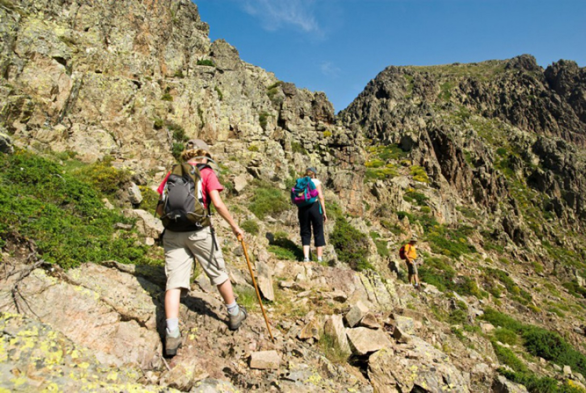
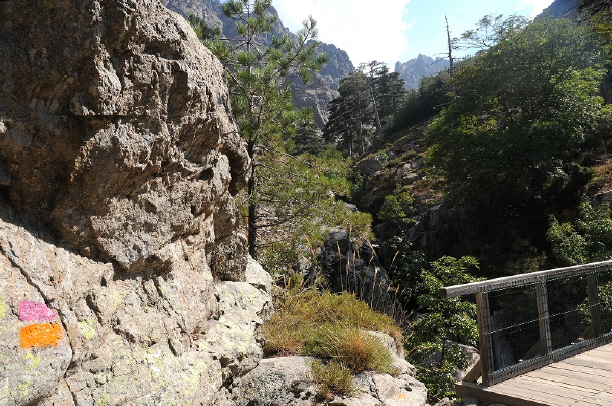
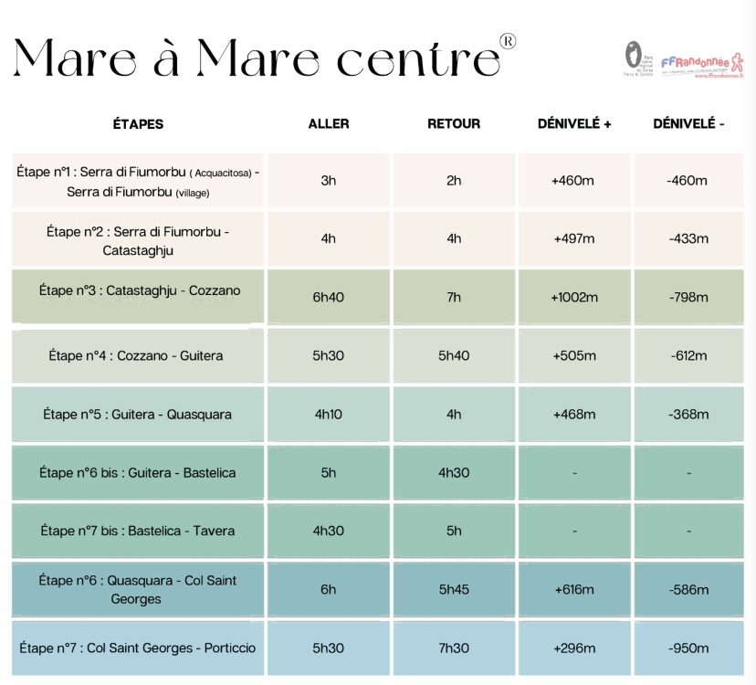
MARE À MARE CENTRE
« Corsica - from east to west »
The Mare à Mare Centre trail starts from Ghisunaccia and crosses from the eastern side of Corsica to the west as far as Purticchju (with an alternative starting point at Tavera). The route takes you across varied landscapes with dense green undergrowth, and it’s the perfect choice if you want to enjoy local products. Although the Mare à Mare Centre is viable year-round, some gîtes close out of season so it’s worth checking in advance for accommodation. This is a walk that can be done without carrying much equipment as you’ll find a drinking water fountain at each stop and a gîte that offers food.
Information sheet for the Mare à Mare Centre trail
From Ghisunaccia to Purticchju (or alternative trail via Tavera) takes 6 to 7 days of hiking depending on the itinerary chosen.
Stages take from 3 to 7 hours
84 km in total and 3900m+ high
 ©PNRC
©PNRC
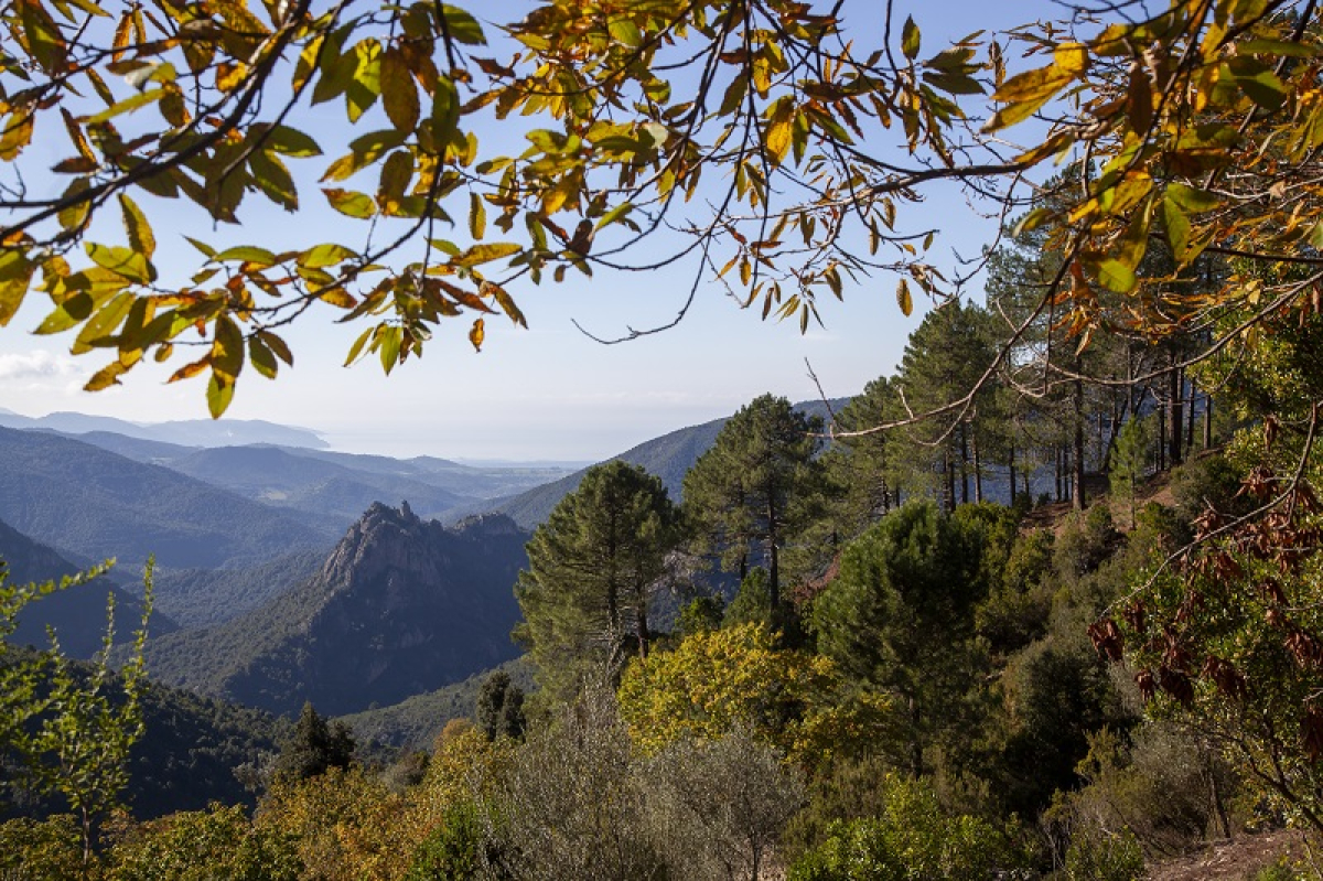
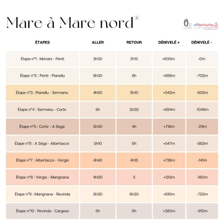
MARE À MARE NORD
« Discover authentic Corsica »
The Mare à Mare Nord hiking trail begins in the village of Moriani and crosses Corsica from east to west as far as the village of Carghjese. The route takes you through pretty villages and regions that have a strong cultural identity, rich cultural heritage and wonderful architecture. You’ll discover stunning landscapes, and stopovers with welcoming villagers and delectable gastronomy. Although the Mare à Mare Nord is passable all year round, some gîtes are closed out of season.
Information sheet for the Mare à Mare Nord trail
From Moriani to Carghjese via Corti (or alternative trail via Venacais) takes 8 to 12 days of hiking
Stages take from 4 to 9 hours
139 km in total and 5900m+ high (161 km and 7300m+ for the alternative trail)
 ©ATC-S.ALESSANDRI
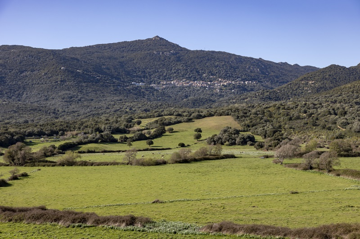
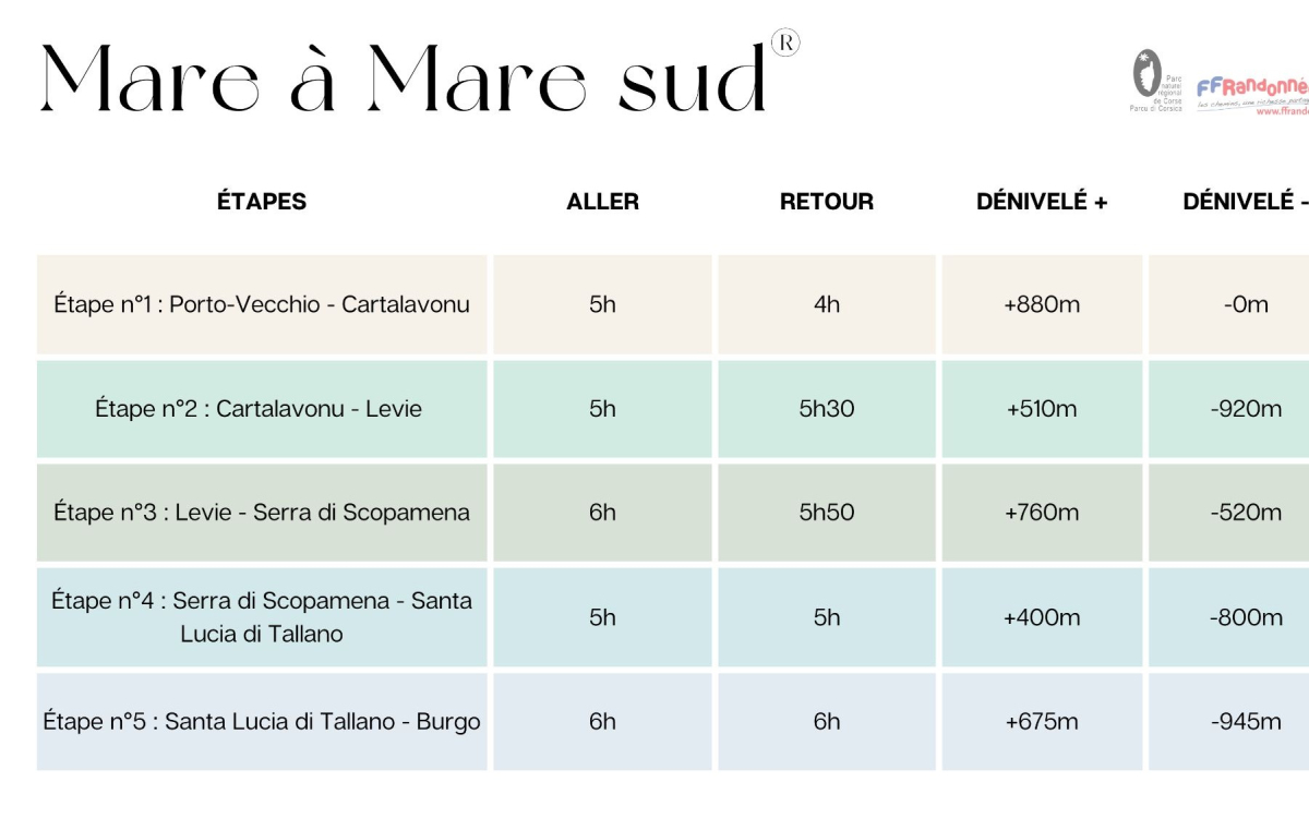
MARE À MARE SUD
« A taste of the south and the far south »
This itinerary features varied landscapes and is accessible to all - even the most inexperienced hiking novices. Depart from Purti Vechju in the south and arrive in Pruprià in the Sartinese Valincu region. The trail is walkable all year round, it rarely snows in winter and remains cool and pleasant in summer thanks to the area’s lush greenery.
Information sheet for the Mare à Mare Sud trail
Departure from Purti Vechju, arrival in Pruprià takes 5 days of hiking
Stages take from 4 to 6 hours
73km in total and 3200m+ high
 ©ATC S ALESSANDRI
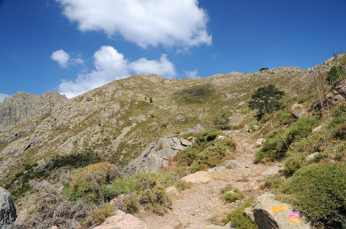
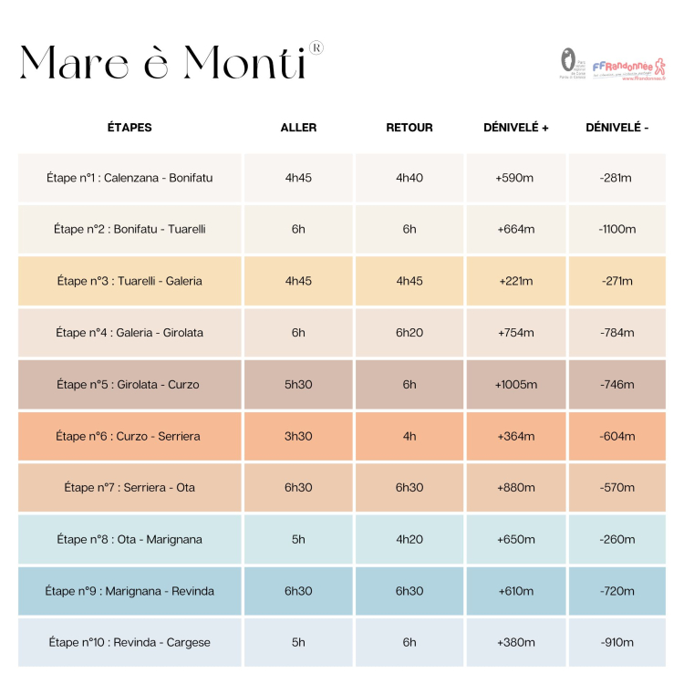
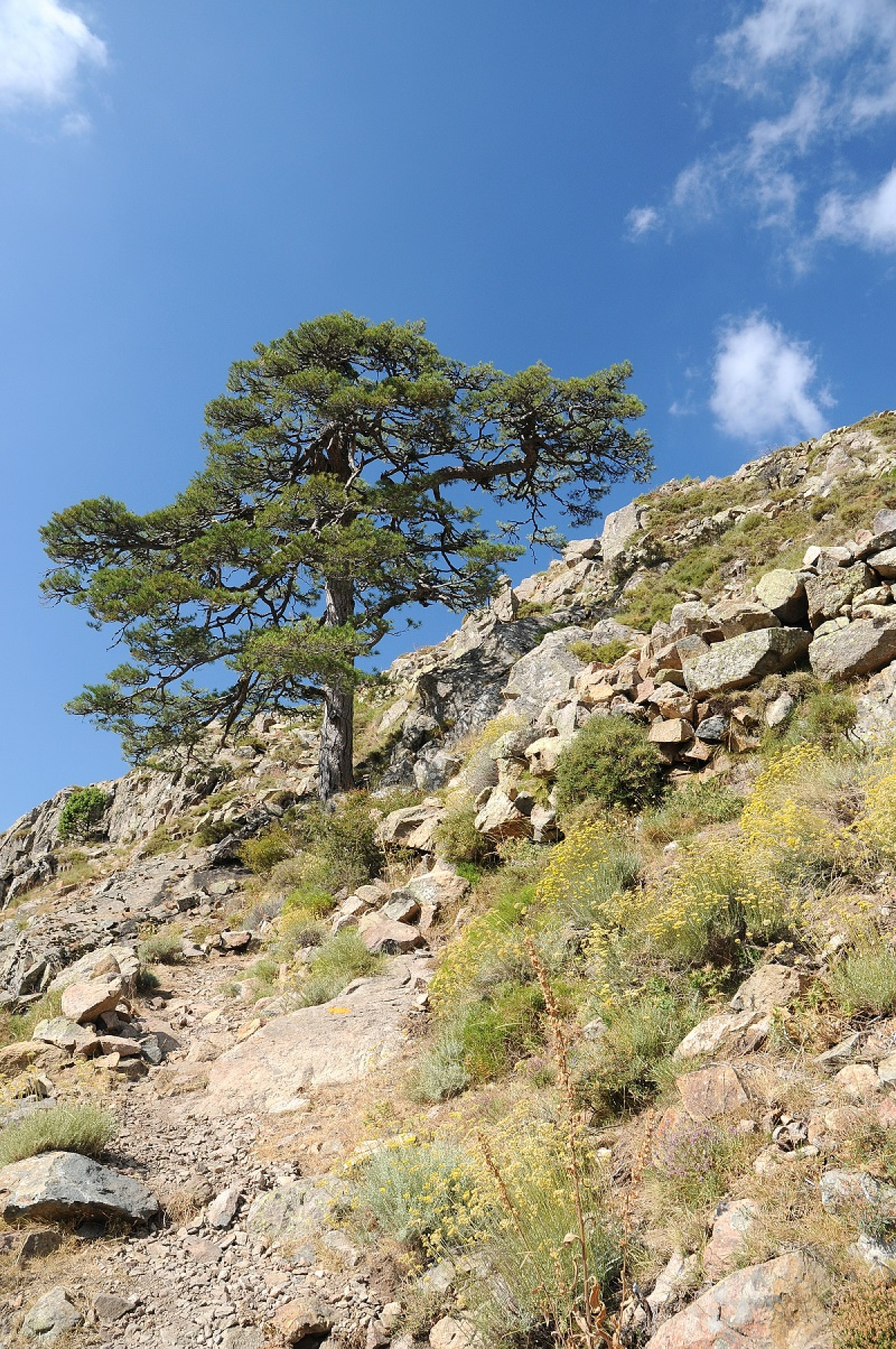
MARE È MONTI NORD
« Breath-taking landscapes »
The Mare è Monti Nord trail starts in Balagne in Calinzana. It follows the line of the seashore on the west coast, while at the same time it is close to the highest mountain peaks of the area, making for a route of varied landscapes. The trail ends in Carghjese.
Information sheet for the Mare è Monti Nord trail
From Calinzana to Carghjese
10 days of hiking
9 Stages from 4 to 6.5 hours
121km in total and 6100m+ high
 ©PNRC
©PNRC
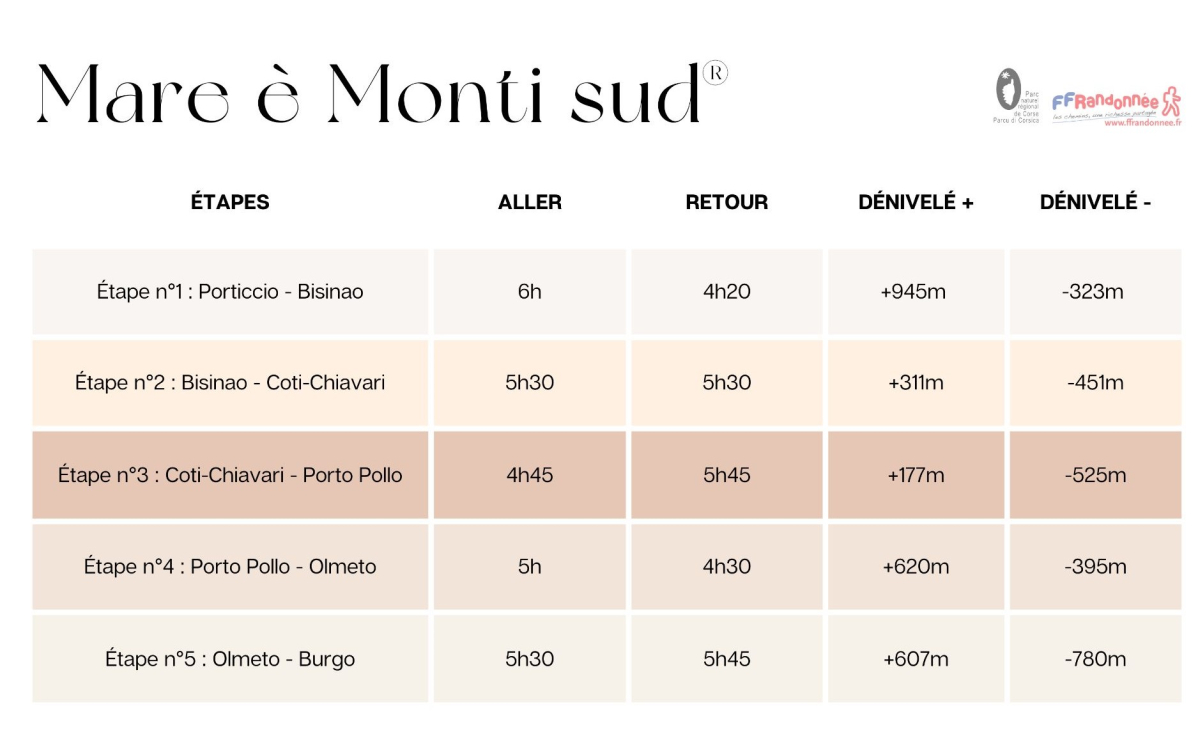
MARE È MONTI SUD
« A balcony overlooking the sea »
This itinerary is ideal for exploring both the traditional interior of Corsica and the enchanting shores of the gulfs of Aiacciu and Valincu.
Information sheet for the Mare è Monti Sud trail
Purticchju to Pruprià
5 days of hiking
Stages take from 5 to 6 hours
66km in total and 2700m+ high
 ©PNRC
©PNRC
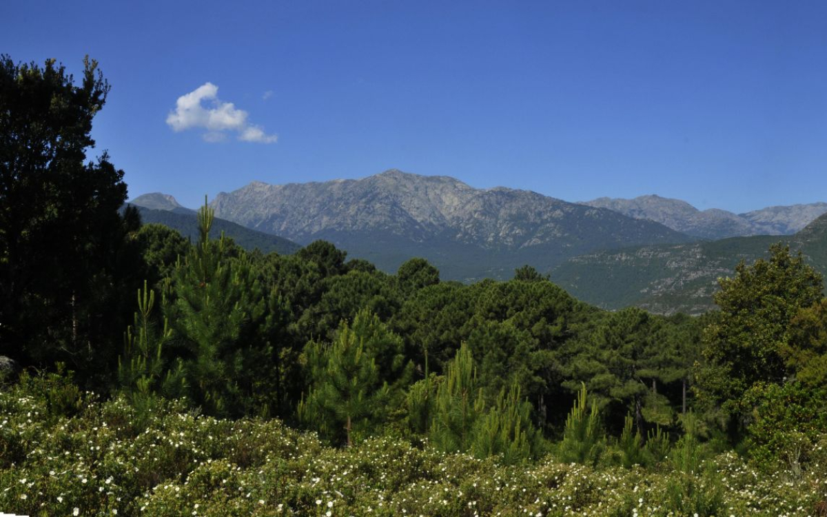
MARE È MONTI LIVANTINU
‘The wild world of the Corsican maquis’
On the border between Upper Corsica and Southern Corsica, the Mare è Monti Livantinu takes you from the Solenzara Bridge to Vivario. Seven days of hiking in the heart of the Corsican maquis and lush green countryside. With no particular difficulty, it can be enjoyed all year round.
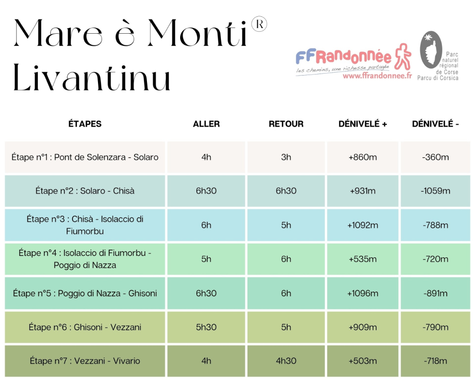
Mare è Monti Livantinu at a glance
From Solenzara to Vivario
5 stages
7 days of hiking
Stages lasting 4 to 6.5 hours
105 km and 5,500 m+
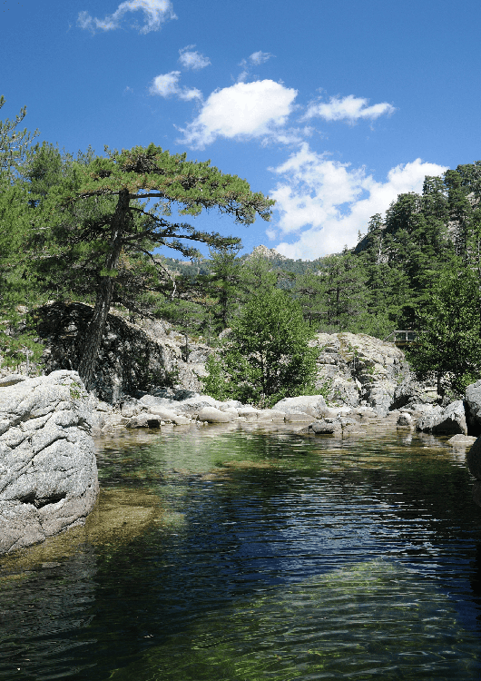
CORTE-OTA
‘The Corsican mountains in their purest form’
Laricio pine forests and exceptional panoramic views between the sea and the mountains are on the agenda for this hiking trail. Four days to connect Corte and Ota, mainly following old transhumance trails.
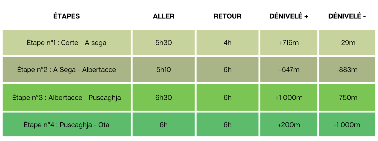
Corte-Ota hike details
4 stages
4 days of hiking
Stages lasting 4 to 6 hours
58 km and 2,500m+
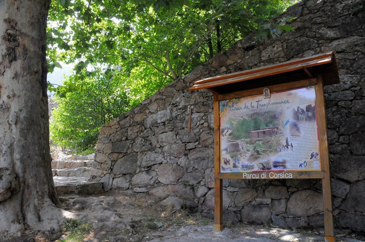
THE TRANSHUMANCE TRAIL
« The authentic shepherds' trail »
Walking along this thousand-year-old path once used by shepherds during the transhumance – the seasonal movement of livestock - is an invitation to discover the island's heritage and traditions. It was once used as a route between the coast and the mountains by travellers on steady-footed mules. The trail connects the Plain to the Niolu mountain.
Information sheet for the Transhumance Trail
Calinzana to Corsica
5 Stages
5 days of hiking
Stages from 5 to 7.5 hours
72km in total and 3900m+ high
 ©PNRC
©PNRC
HIKING SAFELY
• Check weather conditions the day before you travel (especially very sunny days, and rainy days when the path takes you alongside a river).
• Take sufficient water and high energy foods (e.g. dried fruit...)
• Wear good walking shoes and take warm clothes.
• Make sure you have a fully charged mobile phone.
• Follow the advice of mountain professionals.