Rechercher...
25- Is hiking only suitable for experienced walkers?
• Difficult hiking routes:
- The GR20 (from mid-June to mid-October)
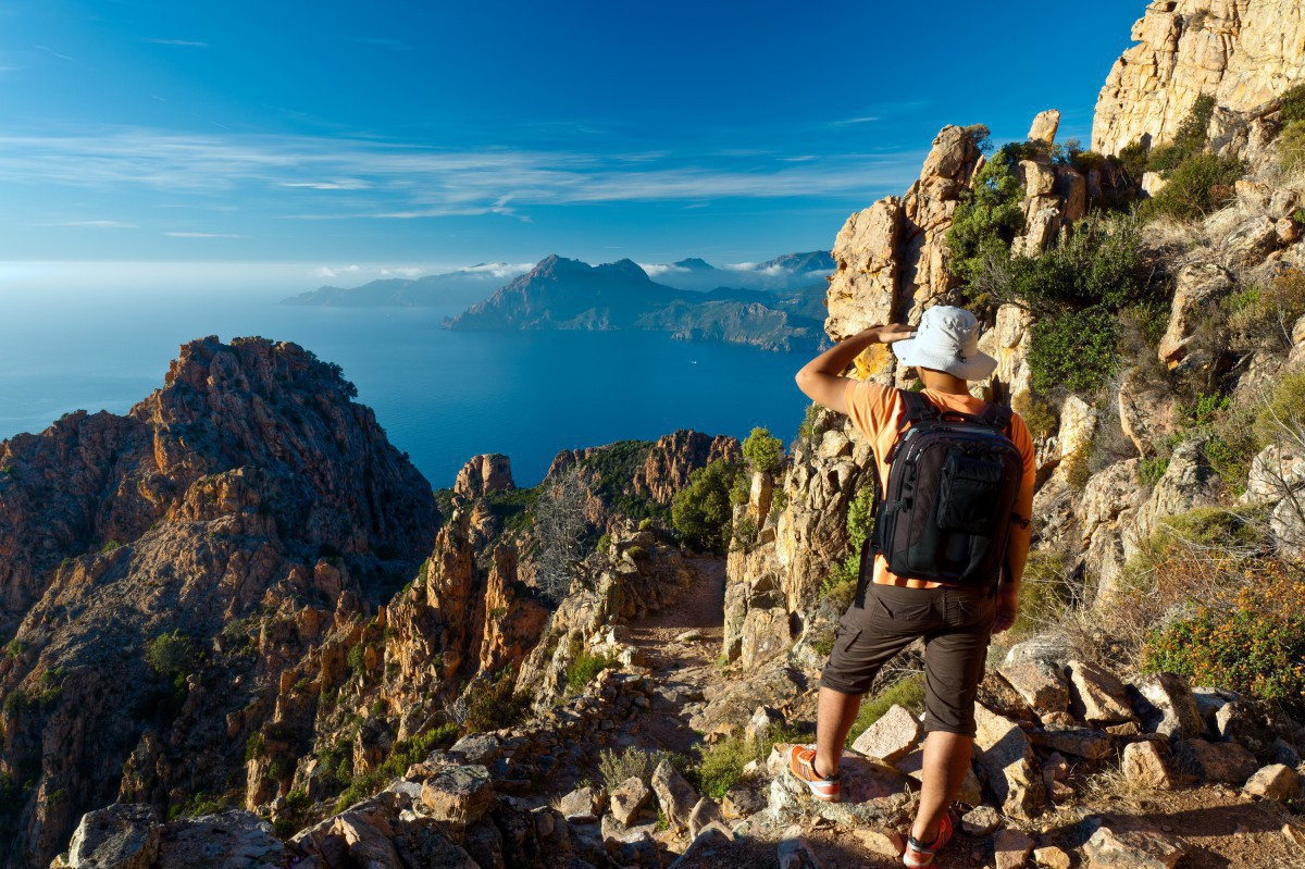
From Calenzana (in the Calvi region) to Conca (in the Porto-Vecchio region), 15 days with daily stages of 6-9hr (it is possible to walk the northern or southern sections in 8 days). Considered to be the most difficult high-altitude hike in Europe, this 200km route passes through the entire length of the Parc Régional Corse at altitudes frequently above 2,000m. Add to this the requirement to carry your own supplies (the route is very isolated with nights spent in mountain refuges) and weather which is often unpredictable, and you will quickly understand why this hike is only for experienced and very well-equipped walkers.
- The Alta Strada (from February to March/April)
From the Asco valley (north-west) to Bastelica (central Corsica). Mountaineering equipment essential. When covered in snow, a section of the GR20 can be covered on skis, resulting in a very challenging winter trek from one mountain range to the next. This is only suitable for experienced skiers and mountain enthusiasts who should always be accompanied by a mountain guide.
• Challenging hikes suitable for everyone:
Five different footpaths traverse the island either from one side to the other (these are known as the "Mare a Mare") or from the sea to the mountains (known as "Mare e Monti"). These routes are not technically difficult, which means that they are suitable for a wider group of walkers who can overnight in a choice of gîtes and hotels.
- Mare a Mare Sud (all year round):
From Porto-Vecchio to Propriano, 5 days with stages of 4-5hr. A varied route which takes in the stunning inland landscapes in the south of the island: the Alta Rocca and the famous Aiguilles de Bavella, the Ospedale lake and forest, archaeological sites etc.
- Mare e Monti Sud (all year round):
From Porticcio to Propriano, 5 days with stages of 4-6hr. This footpath overlooking the sea provides an opportunity to explore the traditional landscapes and villages of inland Corsica as well as the shores of the Golfe d’Ajaccio and the Golfe du Valinco.
- Mare e Monti (all year round but best undertaken when it is less hot)
From Calenzana to Cargèse, 10 days with stages of 4-6hr (possibility of reducing this to 7 days). One of the most popular hiking routes as it passes close to the famous Scandola nature reserve via pretty inland villages and hamlets.
- Mare a Mare Centre (from April/May to October/November)
From Ghisonaccia to Porticcio, 7 days with stages of 4-6hr. With several sections above 1,500m, this route passes through a relatively unknown region dotted with a number of tranquil villages.
- Mare a Mare Nord (from April/May to November)
From Moriani to Cargèse via Corte, 12 days with stages of 4-6hr (variations possible). Another footpath with sections above 1,500m, this route skirts along the foot of numerous Corsican peaks and provides a comprehensive tour of the north of the island (the region of Castagniccia, Le Niolo, the Aïtone forest and Golfe de Porto).
• Easy hikes:
The waymarked "Sentiers de Pays" (country paths) that also run through the Parc Naturel Régional Corse enable visitors to explore the natural and cultural landscapes of eight Corsican micro-regions along walking routes ranging in length from 2-6hr. As a family, why not discover the chestnut groves of the Castagniccia, the Romanesque chapels of the Bozio region, or the streams and valleys of the Alta Rocca? Beyond the boundaries of the park you can enjoy a whole host of magnificent walking routes, such as the "sentier douanier", which runs along the northern tip of Cap Corse, or the coastal path skirting the Désert des Agriates.
• Walking holidays organised by tour operators: for those who prefer not to walk on their own, a number of specialist tour operators organise walking trips for small groups. Those interested in this type of holiday should contact the tour operators directly.